Geomagnetism - Data and Services
Real-time Geomagnetism Services
For the Oil Industry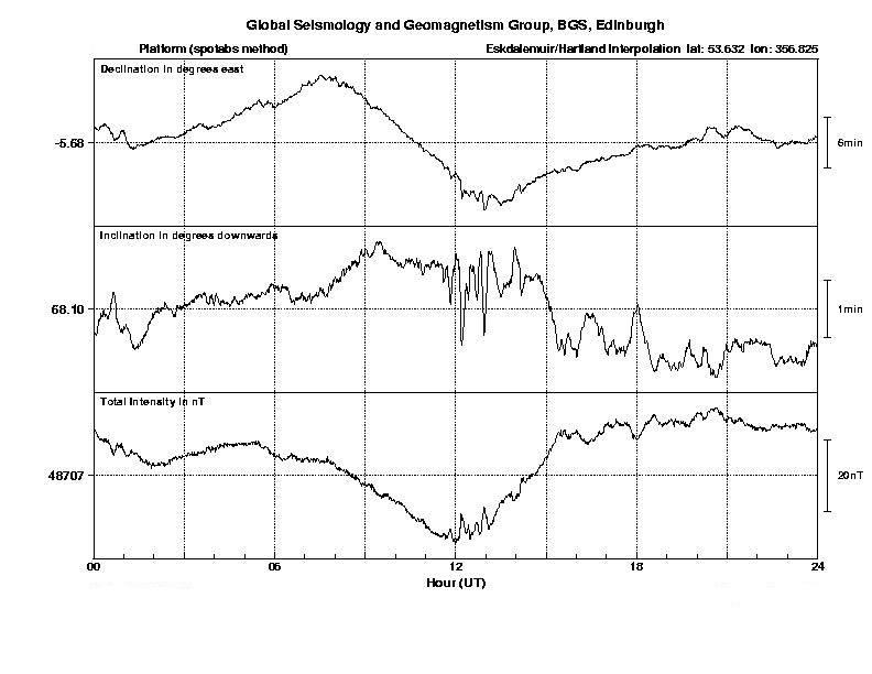
Interpolation In-Field Referencing (IIFR) is a method for determining the geomagnetic field, in real-time, with uncertainty estimates, at a drilling site where magnetic survey tools are being used for navigating well-bores. IIFR data incorporate real-time data from nearby observatories, local magnetic survey data and values from the BGS Global Geomagnetic Model. They thereby include magnetic fields from all sources - in the Earth's core, the crust, ionosphere and magnetosphere. More information is available in the paper "Space Weather Services for the Offshore Drilling Industry" 225kB pdf.
For the Electricity Supply IndustryAn hourly standard deviation (HSD) value is a proxy for the power in the geomagnetic field variations which drive surface electric fields and potentially damaging geomagnetically induced currents (GIC). HSD values of the geomagnetic field as measured at the three UK observatories can be supplied in real-time to grid control centres. More information is available in the paper "Monitoring Geomagnetically Induced Currents in the Scottish Power Grid" 239kB pdf.
Monitoring, Alert and Forecast ServicesUsing geomagnetic data from UK and global observatories and a variety of data from satellites monitoring the solar wind and the sun, real-time monitoring, alert and forecast services can be set up and tailored to users' requirements. More information is available in the papers "A Review of the Effects of Space Weather on Ground-based Technology" 27kB pdf and "Improved Predictions of Solar and Geomagnetic Activity with Application to ESA/LEO Satellite Operations" 405kB pdf.
Global Magnetic Field Modelling
The BGS Global Geomagnetic Model (BGGM), a model of the Earth's present and future magnetic field, is derived every year and is available under licence along with the associated software. The accuracy of this model is maintained and, where possible, improved by continuous updates to the datasets on which it is based, and development of the modelling techniques employed.
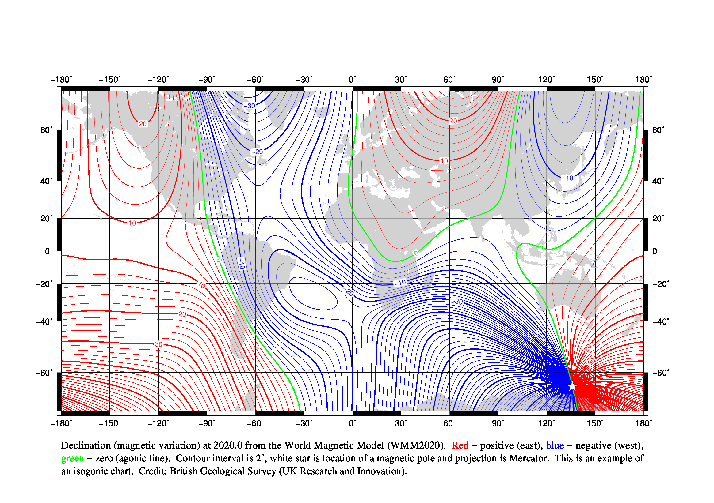
For General NavigationThe World Magnetic Model is used widely in military and civilian navigation and attitude and heading referencing systems. It is also used to determine isogons and compass rose values for sea charts. It is revised every five years as part of a collaborative project
Local Magnetic Field Modelling
For the Mapping Industry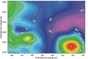
A model of the Earth's magnetic field over the UK is produced every year using observations from the network of repeat stations in the UK and data from the observatories. This model is used to determine the direction of magnetic north for maps and compass-users.
For the Oil IndustryThe direction and strength of the crustal magnetic field along a well-path can be determined from local aeromagnetic or marine total intensity (i.e. scalar) data using Fourier transformation techniques. This can substantially reduce the uncertainty in the BGGM values applied at drilling sites where magnetic survey tools are being used for navigating well-bores, particularly at low latitudes where the external field is less significant. This service is called In-Field Referencing and has been applied in Caspian Sea, Gulf of Mexico, North Sea and offshore Africa.
Measuring the Magnetic Field
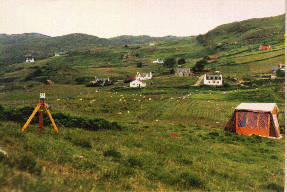
Using non-magnetic fluxgate theodolites, gyro-attachments and proton precession magnetometers and other specialist equipment, BGS surveyors are able to go to any location on land and make accurate absolute measurements of the local magnetic field.
Data LoggersThe Geomagnetic Data Acquisition System (GDAS) 416kB pdf developed by BGS has been installed in all the BGS observatories both in the UK and overseas and has also been sold to magnetic observatories around the world. This QNX-based logger can be easily adapted for use with other sensors, for example, seismometers and environmental sensors.